TESTIMONIAL & Case Study
ABOUT ACS
ACS Engineers is a civil and environmental engineering and project management company based in Beaudesert, Southeast Queensland. Services include design services, feasibility studies, asset condition inspection, project scope and initiation, cost and budget management, flood recovery assessment, stormwater management, structural and footing inspections, civil inspections, bulk earthworks design, and erosion and sediment plants and designs.
The company was proud a finalist in the Scenic Rim Business Awards and is a preferred supplier for multiple Scenic Rim Regional Councils.
As project managers, ACS Engineers takes on the role of communicators and drivers with relevant stakeholders and contractors to ensure the correct works are carried out according to requirements, budgets and schedule.
They service a range of clients, from property owners and local Councils; to medium and large residential; and agricultural and industrial developers.
The CHALLENGE
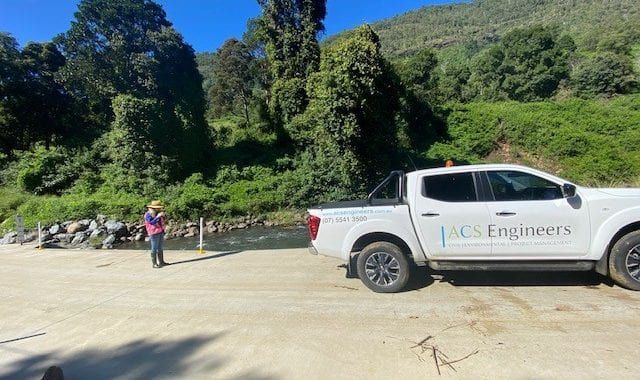
In 2017 the Scenic Rim region was heavily impacted by Tropical Cyclone Debbie and there was a need to capture data on the water-caused damage immediately. As well as infrastructure repair there was a major concern for Public Safety. The Council commissioned ACS Engineering with the monumental task of assessing over 520 culverts. With a maximum capacity ofaround 10 culverts per day, Managing Director Angela Harlen knew urgentaction was needed.
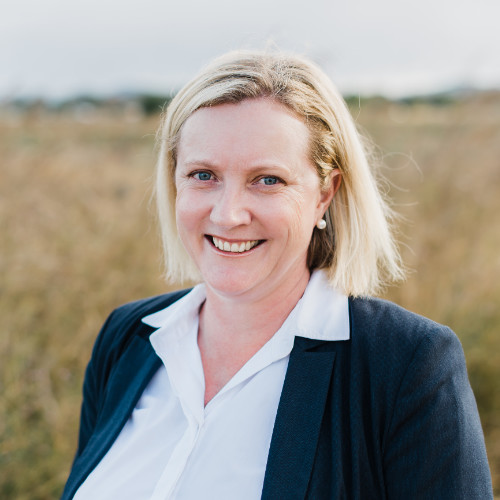
“After only a few days we knew we would struggle to capture the data quickly and accurately. Plus, the deadline pressure represented a very real risk to our employees who were distracted while focusing on navigating to locations whendriving,” said Angela.
“I recalled seeing a post on LinkedIn about Mobile Data Anywhere, so I reached out to Michael Josefski, and after an initial conversation, I knew his solution was the answer. Michael’s response was immediate and encouraging. He worked with our designer into the night, uploading and categorising the asset register into a GIS file format.” (A GIS file format is a standard of encoding geographical information into a computer file. They are created mainly by government mapping agencies).
“The result was astonishing. From an original estimate of more than 6 weeks, we completed the entire project in just over a week. We quite literally ‘blew them away’ which resulted in the Council increasing the project from the small area covered in the original brief to the entire region – it was a real game-changer for us. The council and statutory bodies were amazed at the speed and accuracy of our report and more than one person wanted to know how we did it!” concluded Angela.
The SOLUTION
One of the key benefits to evolve from the Cyclone Debbie project was understanding that the MDA solution was not just about immediate assessment of flood damage.
“While we were there we also collected data on the assets and their condition – ideal for maintenance planning and risk mitigation that is mandated for statutory bodies,” Angela continued.
“The MDA solution was not only a game-changer for us it also made a really huge difference to the regional councils we serve. They were able to gain more funding because of how quickly they were able to submit their asset management status reports.”
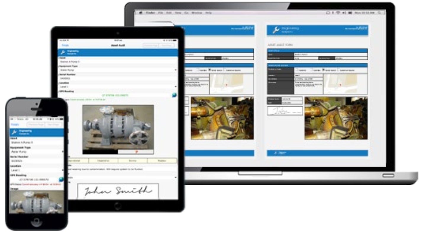
“In addition, using Mobile Data Anywhere has provided our field team with more than just the ability to find, record and report on widely scattered assets. Their safety is paramount, and the GPS within the MDA software means their focus is on driving – not navigating.”
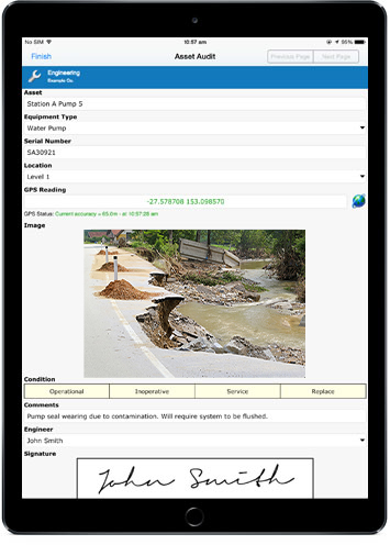
“All of our field operatives now use a tablet and are able to methodically step through the inspection process, including capturing and notating images for their reports. The increase in productivity is immeasurable.”
“Something I didn’t see coming was the improvement in the team dynamic and interaction. Everyone has a real sense of achievement with a system that really accelerates their ability to go above and beyond, and totally own the inspection outcomes,” she ended.
Another key feature for us is file formatting from within the software. Every government body has specified file formats that they want information in, and manipulating data to suit mandated file formats is not negotiable.
“Doing it on-the-fly in MDA makes file reformatting cost and resource effective. We’ve all lived with the pain of manually adapting one document type into another!”
“The software is highly customisable and is finely-tuned in respect of asset location like GIS and GPS data.”
“Another very welcome feature is the ability to tap on the map to confirm whether an asset has been checked, or still needs to be done. This small feature means a lot to the people in the field. Prior to this they’d come back to the office believing the job to bedone, only to download all the data and discover something was missed and frustratinglythey needed to go back out to get it,” commented Angela.
The SERVICE
“It wasn’t expensive and that just blew us away! It’s fair to say that the implementation of MDA has paid for itself in spades. In terms of what it cost to what it has delivered in productivity and client satisfaction it’s just simply a no-brainer.”
“Support is another tick in the box. Any issue or question has always been resolved promptly, so regardless of which team member we’re speaking with, we get the same high level of attention and service from the MDA team.”
“Another surprising aspect is how open the team at MDA have been to customising the software to meet our specific needs. Unlike most people who say: ‘our software does it that way – end of story’, they take our feedback onboard and is constantly improving the app as a result.”
“This has become a big thing for us and something we have really enjoyed is the interaction. The MDA team first asks what the outcome is that we need to deliver, and he’s prepared to tailor the software so we can deliver a best-in-class service,” concluded Angela.
The OUTCOME
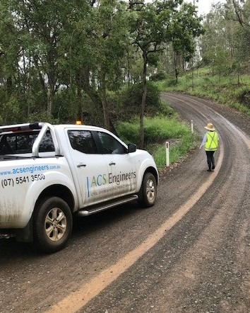
Almost immediately after the flood events of Cyclone Debbie the region was hit with drought, bring its own set of challenges in asset maintenance and monitoring.
Due to their incredible performance during the floods, the Scenic Rim Regional Council had ACS Engineering as their first port of call.
“I have no doubt that the MDA solution is a huge part of this success and the positive reputation we have built within the ranks of government agencies,” said Angela.
The FUTURE
Asset Data Collection and Flood Assessment was never really a part of ACS Engineering’s core service mix – until they chose Mobile Data Anywhere as their digital partner.
“We’ve been able to gain a service offering that we never thought we would, and having MDA software as an integral element in that process
has given us the confidence to approach other Councils and Government bodies, and significantly grow that part of the business.”


CONCLUSION
“Through our work with some Councils we have been exposed to other software which
makes the same claims as MDA, and we always comment that the one we use is much better.
I think MDA has a real point of difference in terms of flexibility and ease of use. And it’s very
cost effective.
“I honestly don’t think we would ever have looked to do more flood assessments if it wasn’t
for the brilliant software we were given in 2017,” concluded Angela.
Create Powerful
Mobile Forms for your Business in Minutes!
Design, Collect, Report - anywhere, anytime for Asset Condition Assessment
- Improve accuracy and speed of data capture
- Reduce double entry and lost paperwork
- Generate reports instantly once data received
Give FieldLogic A Try!
We’ll Build Your First Form Free.
©FIELDLOGIC 2023. ALL Rights Reserved Privacy Policy Website Terms

